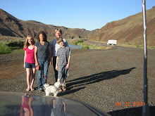
We are in southeast Oregon working our way (not on a main freeway) to Central Point, Oregon. I learned on this trip that a route to somewhere can be on a map and it can look like a good straight route but the elevation is something to consider as well. Do I regret all the mountainous driving - absolutely not. That main freeway, yes, you see the land too but not like this. Well Oregon was not a straight flat path either. Imagine constant driving up and down mountains through unending forest and national parks. You know the roads where the heavy forest trees are on both sides of you hugging the road and it meanders right left sharp turns back and forth for hours. I don't think I have ever been in national parks so long and for so many miles. Every now and then we would see through trees at the beautiful mountains and cliffs and water and more mountains. We were on a huge time crunch with all the stops and elevation driving that took more time so photo shooting didn't take place. It was hard to tell when we were getting close to Ashland Oregon which was 30 miles south of our destination and we thought the exit back to a main freeway.
View Larger Map
Subscribe to:
Post Comments (Atom)
No comments:
Post a Comment